Robotics
Artificial Intelligence
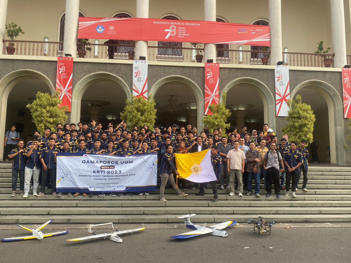
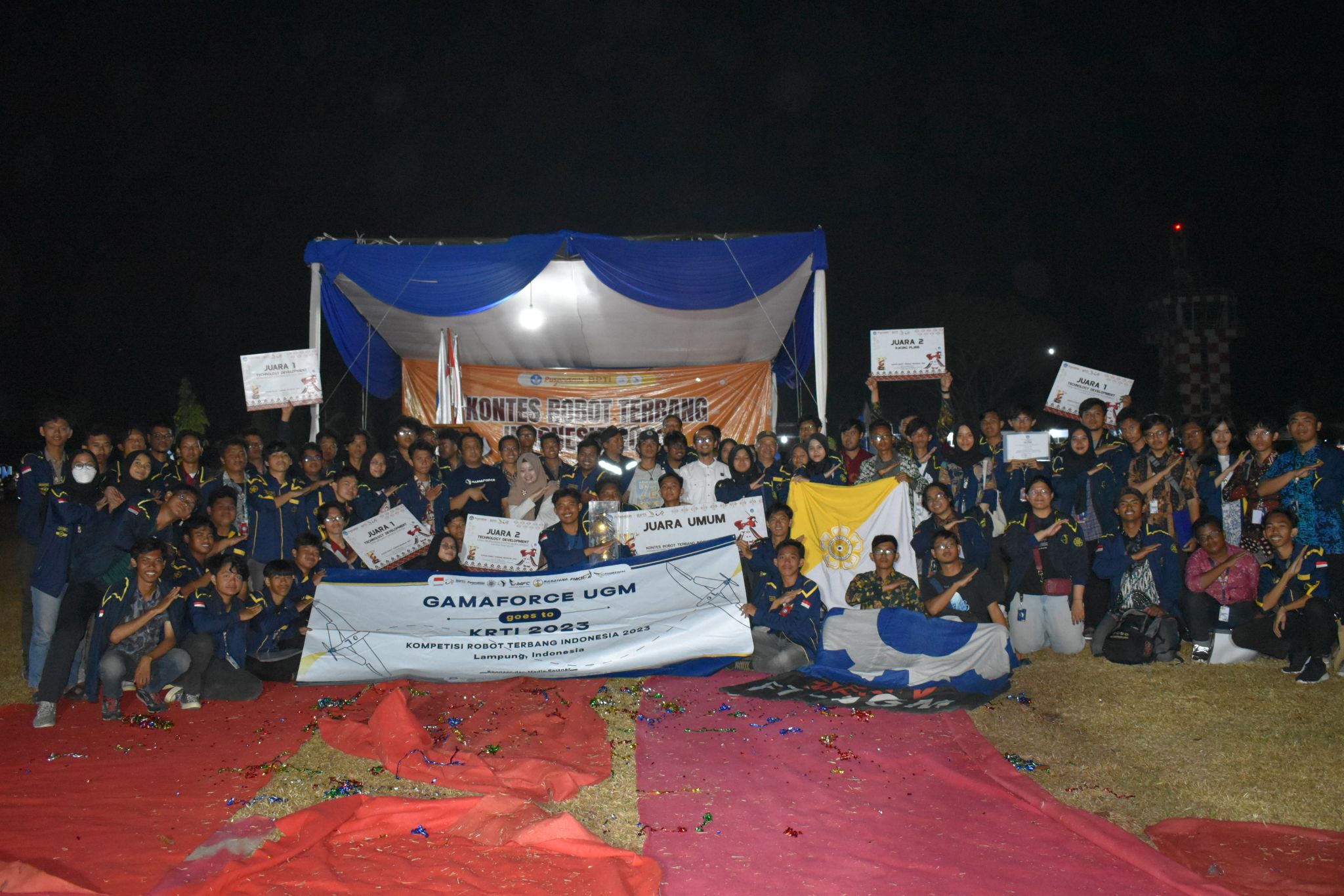
Gadjah Mada Flying Object Research Center(GAMAFORCE) UGM
Gadjah Mada Flying Object Research Center(GAMAFORCE) UGM
Gadjah Mada Flying Object Research Center(GAMAFORCE) UGM
Dec 1, 2022
-
Dec 30, 2024
Overview
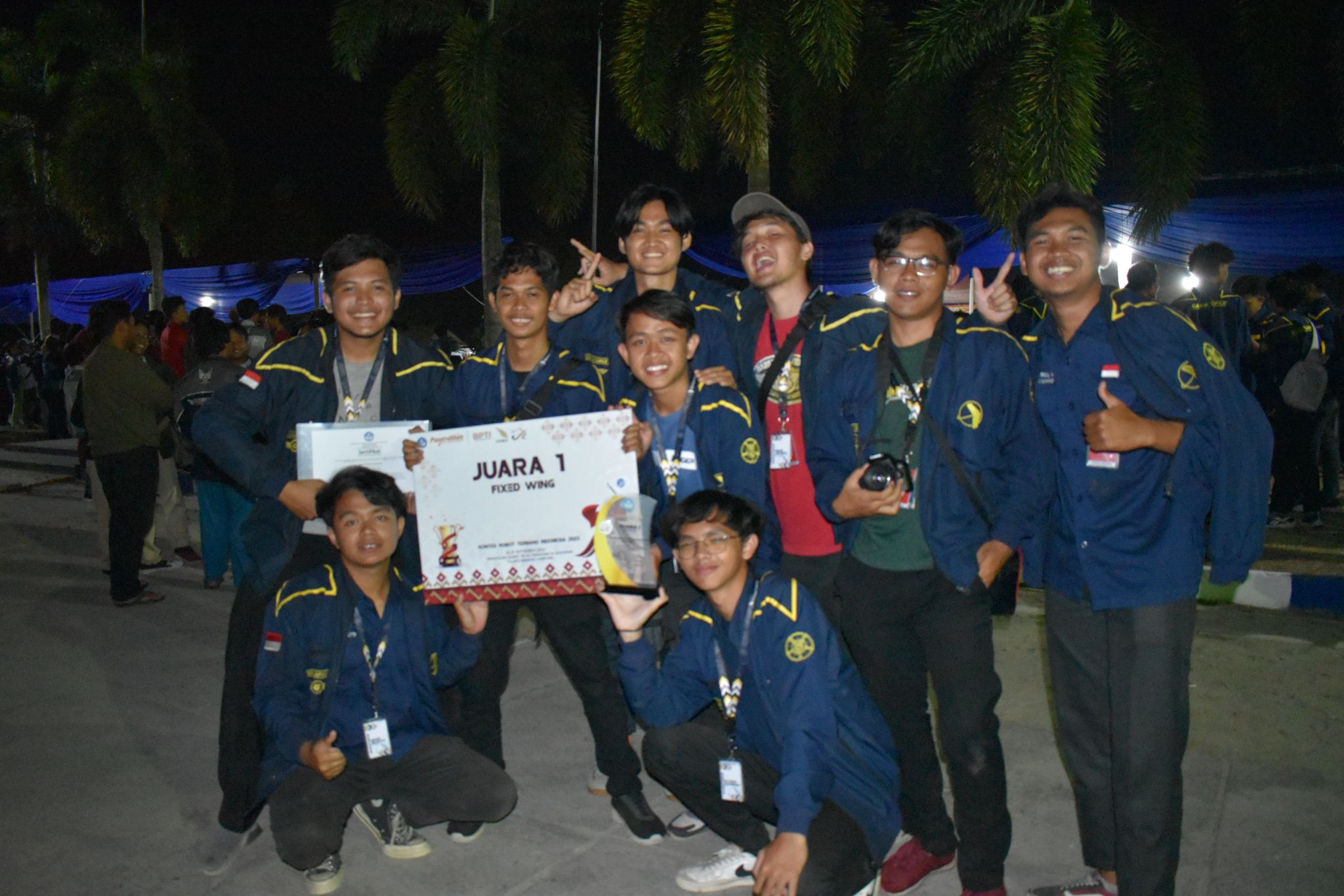
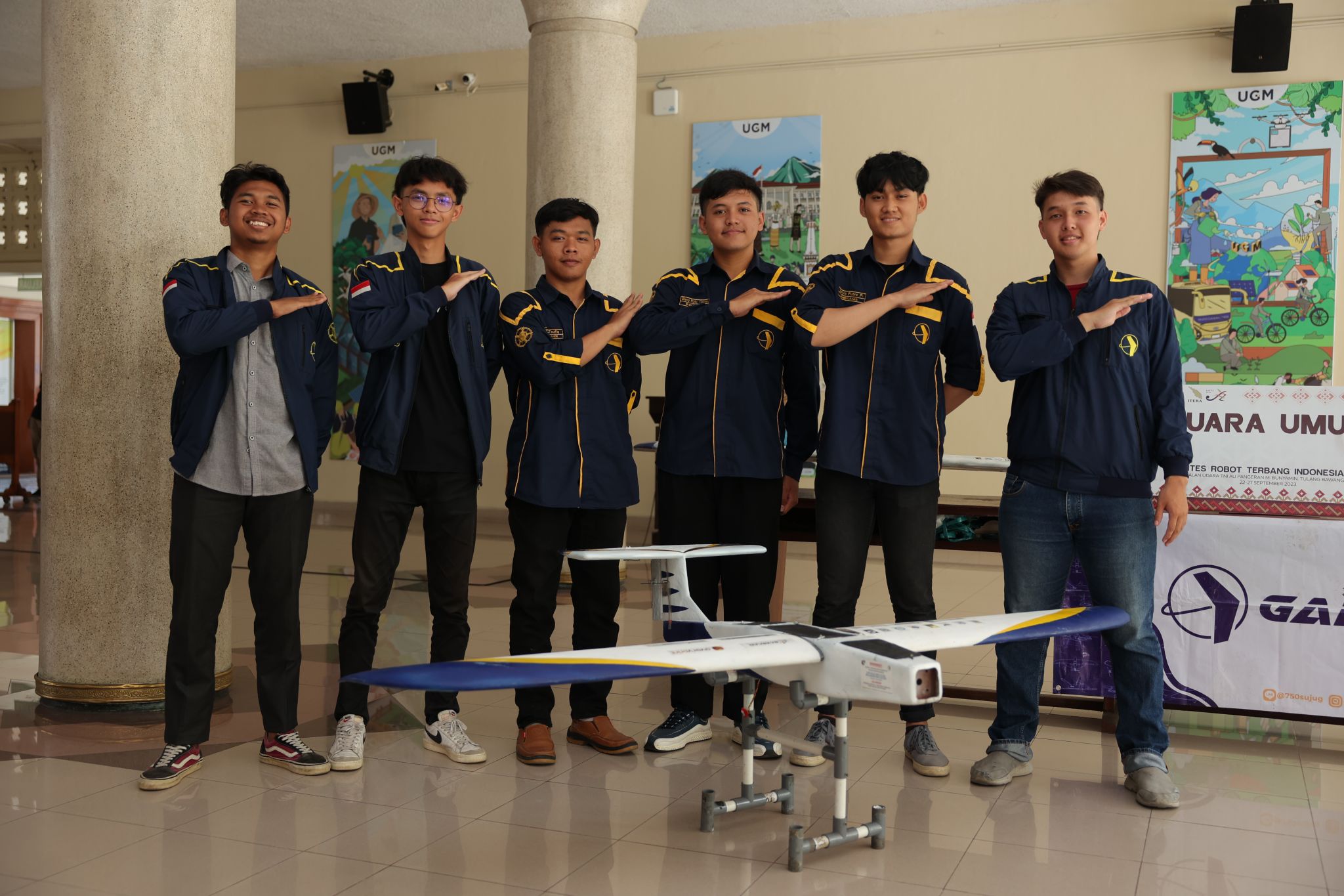
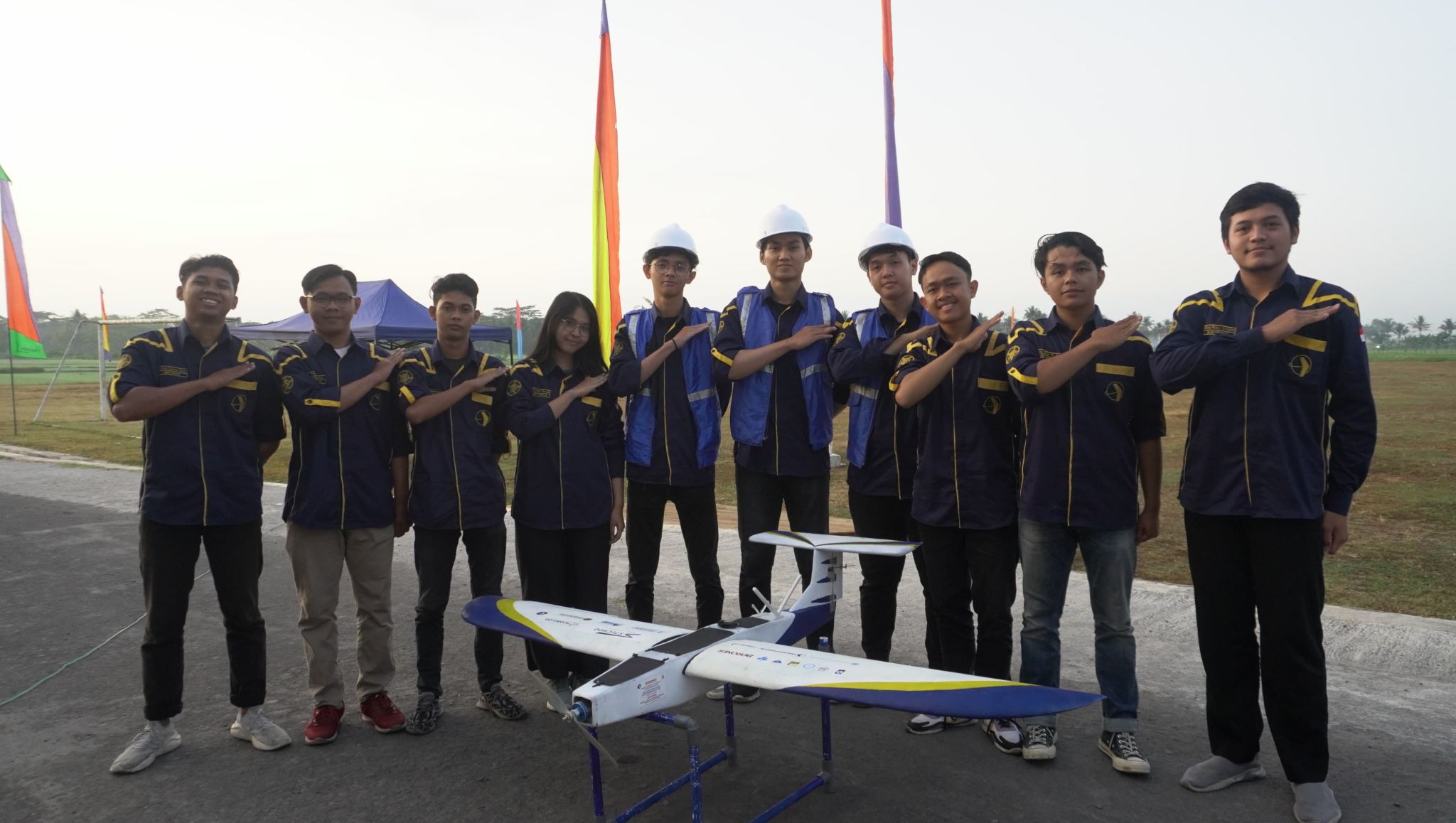
As a member of GAMAFORCE, Universitas Gadjah Mada's premier UAV research team, I served in two specialized roles: Electrician and Geospatial Mapping Staff. This multidisciplinary team focuses on designing, assembling, and operating unmanned aerial vehicles (UAVs) for competitive and research purposes.
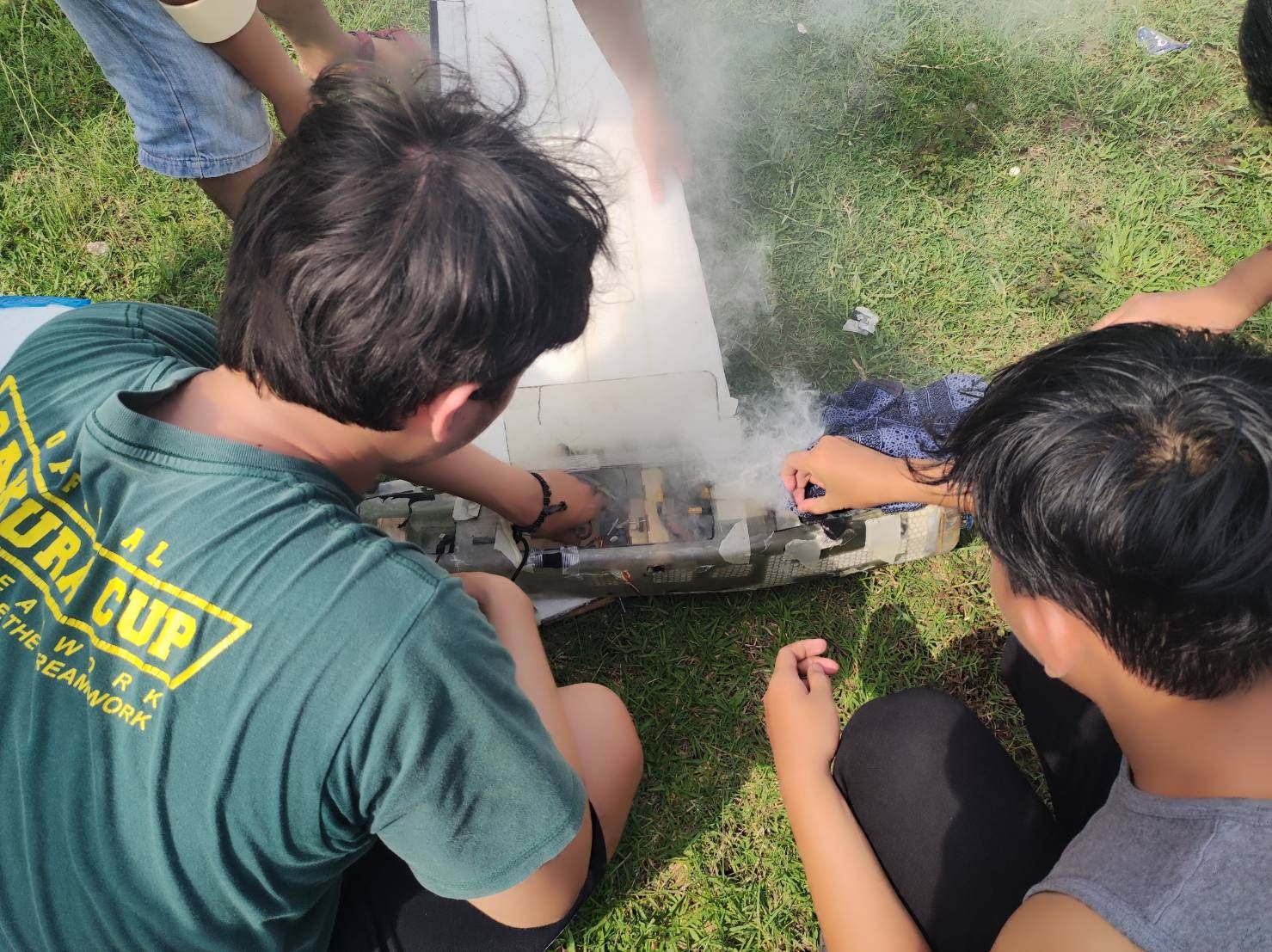
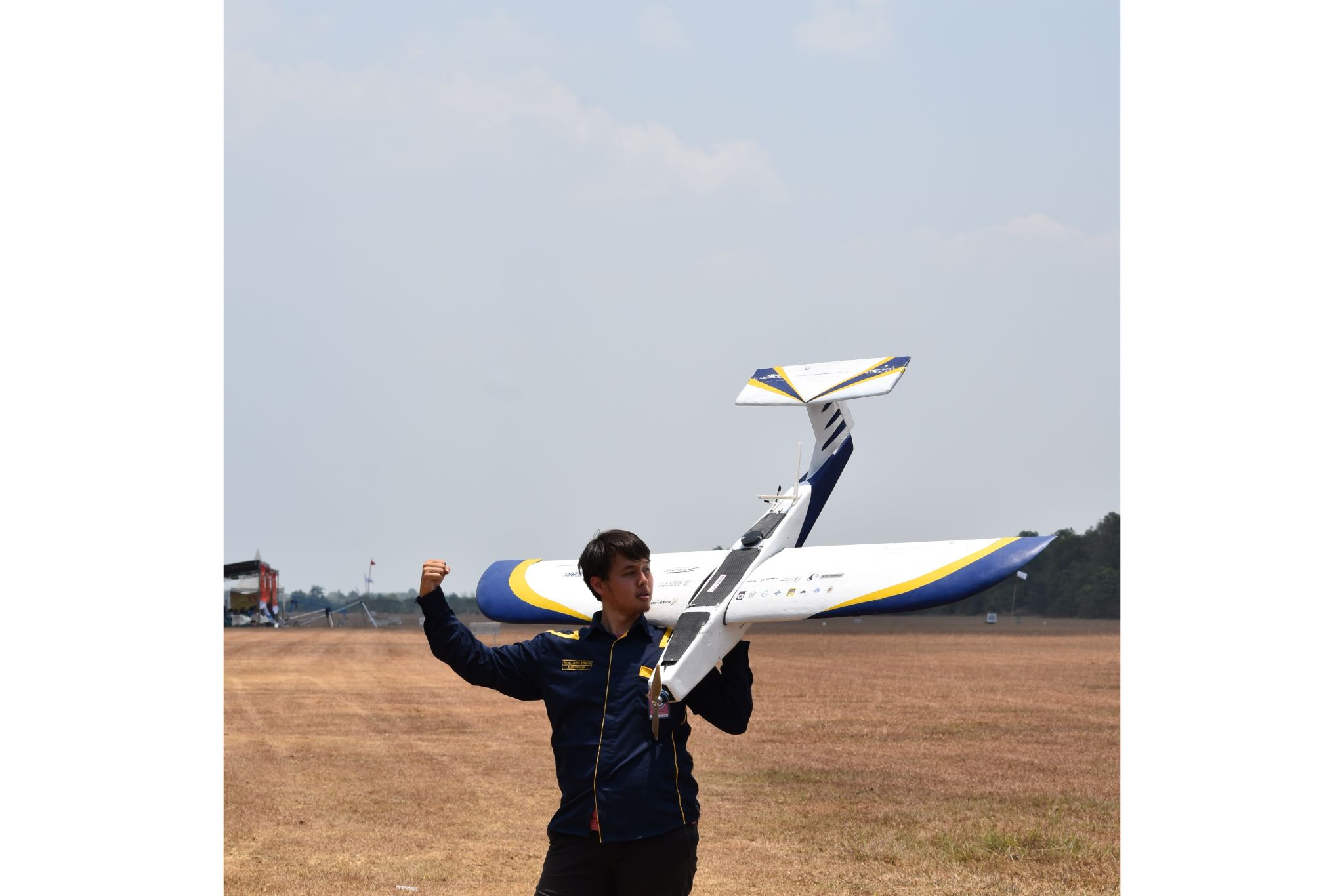
In my role as an Electrician, I was responsible for assembling and wiring critical electrical components of UAVs. This included power distribution systems, motor controllers, servos, and onboard electronics, ensuring that every electrical connection was both efficient and reliable. I worked closely with mechanical and avionics teams to integrate electrical systems seamlessly with sensors, propulsion units, and communication modules.
Alongside this, I contributed to the Geospatial Mapping division, where I processed and analyzed spatial data captured during UAV flights. I utilized GIS tools to interpret terrain models, generate accurate maps, and support mission planning. This work was crucial in applications such as autonomous navigation, aerial surveying, and data visualization for research outputs.
Overview
As a member of GAMAFORCE, Universitas Gadjah Mada's premier UAV research team, I served in two specialized roles: Electrician and Geospatial Mapping Staff. This multidisciplinary team focuses on designing, assembling, and operating unmanned aerial vehicles (UAVs) for competitive and research purposes.
In my role as an Electrician, I was responsible for assembling and wiring critical electrical components of UAVs. This included power distribution systems, motor controllers, servos, and onboard electronics, ensuring that every electrical connection was both efficient and reliable. I worked closely with mechanical and avionics teams to integrate electrical systems seamlessly with sensors, propulsion units, and communication modules.
Alongside this, I contributed to the Geospatial Mapping division, where I processed and analyzed spatial data captured during UAV flights. I utilized GIS tools to interpret terrain models, generate accurate maps, and support mission planning. This work was crucial in applications such as autonomous navigation, aerial surveying, and data visualization for research outputs.
Findings
Being part of GAMAFORCE taught me the value of precision, interdisciplinary teamwork, and iterative engineering. As an electrician, I learned how vital reliable power and signal flow are to the success of flight missions. Even the smallest wiring flaw could result in a mission failure, which instilled in me a deep attention to detail and discipline in quality control.
In the Geospatial Mapping role, I developed a strong understanding of how data drives decision-making in UAV operations. I discovered the power of spatial analytics in supporting real-world applications, from topographic modeling to infrastructure planning. Handling GIS software and interpreting aerial imagery expanded my technical toolkit and complemented my hardware engineering knowledge.
Overall, my GAMAFORCE experience strengthened both my technical execution and analytical thinking, giving me a well-rounded foundation in both UAV hardware systems and data-driven mission support. It also fostered a deeper appreciation for collaborative innovation and real-world problem solving through engineering.